An effective method used in our project.
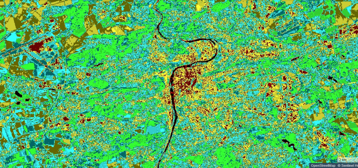
One of the tools available to our students within the PULCHRA project is the Remote Sensing (RS) Tool. The tool allows students to explore satellite imagery and obtain data that can support or complement their own research.
Remote sensing provides us with data acquired by sensors on satellites, planes or drones. Data acquired this way are then evaluated and analyzed by geographic information systems (GIS). The results are presented in the form of a map.
“Remote sensing is one of the fastest growing areas of science. It allows us to observe changes of Earth’s surface efficiently,” says Přemysl Štych
You can read about ways in which remote sensing is used within the PULCHRA project in the interview with Přemysl Štych, senior lecturer at the Department of Applied Geoinformatics and Cartography, Charles University. Charles University is one of the partners of the PULCHRA project. Přemysl Štych and his team help the students with data processing and interpretation.
One of the tools available within the PULCHRA project is remote sensing. What led you to this area of research?
I got to remote sensing thanks to my main area of research: researching the status and changes of land use. Examining the landscape is now practically impossible without data from satellites. My first remote sensing teacher was Martin Šíma. He was a real expert and a great teacher. Mr. Šíma was also a big supporter of the international science and education program GLOBE and also worked with the Educational center TEREZA (the partners of the PULCHRA project in the Czech Republic). Unfortunately, he passed away some time ago, but he would be really glad that I’m trying to follow up on his efforts to make remote sensing more integrated into school curriculum as well as used as a means to evaluate the quality of our environment.
In your opinion, what is the importance of remote sensing when researching a city as an ecosystem of its own?
The data acquired through remote sensing offer a complex overview of urban ecosystems. Remote sensing can differentiate between individual categories of land use, can measure the area and status of vegetation or measure the amount of water in the soil. Thanks to its ability to measure various temperatures, we have information about the temperature of Earth’s surface. Radar technologies enable us to get information about the movement of terrain or even about the movements of buildings. Last but not least, thanks to modern satellites, we can measure the levels of air pollution.
The fact that we have the data in a timeline and that we can assess the changes of individual components of urban ecosystems is a huge advantage. Modern satellites can focus on objects using a resolution better than 50 cm. We can thus monitor objects and phenomena in great detail.
Is it possible to use this tool in all of the City Challenges?
Remote sensing is a key component of geoinformatics. It focuses on research tasks in 3D. We concentrate on data collection, distribution and analysis, as well as 3D visualization of the acquired data. Remote sensing can be used in the majority of the City Challenges. More precisely within projects concerning research of a specific area and its characteristics. Remote sensing offers precise data acquired over a long period of time and outside the spectrum of our perception. It allows us to determine important properties of analyzed areas, such as temperature of surface, health status of vegetation or amounts of water in the soil.
Could you think of a specific example of how to use remote sensing within these projects?
Climate changes are a big topic right now. Urban ecosystems are not that resistant to these quick temperature shifts due to larger amounts of built-up areas and less vegetation. Data acquired from satellites are multispectral, which helps us observe the temperature changes and point out where more vegetation or bodies of water are necessary so that cities don’t overheat.
We know that you work with the Postupická secondary school in Prague. How did this cooperation come to be?
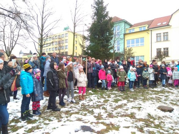
Mainly thanks to the enthusiasm of the students who managed to not only design a really useful project, but also engage the local community in solving the problem of waste separation. During our discussions, the need for analyzing the distance between individual housing units and recycling bins arose. We have thus evaluated the availability of recycling bins in Spořilov, Prague (the neighborhood where the Postupická secondary school is located). Thanks to the use of geographic information systems and the students’ field research, we managed to acquire really important data that can be used when deciding where to place recycling bins in order to recycle as much waste as possible.
The PULCHRA projects offers access to the Remote Sensing Tool and a remote sensing guide. Do you think that the students will be able to utilize this tool without consulting an expert?
The PULCHRA project offers easy and quick access to the remote sensing satellite data. The data, however, are not just pictures. It offers information with great research potential. In order to recognize this potential, the assistance of an expert is necessary.
What message would you like to send to the students participating in the PULCHRA project?
One of the main goals of the PULCHRA project is to introduce modern science and technologies to the students. It supports the students in learning how to collect and evaluate data from their neighborhoods and how to try to help the environment via their own research.
I wish all the participating students and teachers that their discoveries and teamwork bring them joy. When you work together, better results are achieved and more positive changes can be introduced.
